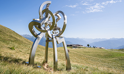
Tour of Monte Tamaro
The ultimate scenic route
Follow the gravel road which takes you from Alpe Foppa to the Capanna Tamaro and then the hiking trail to the summit of Monte Tamaro at 1,962 m a.s.l. From there you can enjoy a 360° view of the lakes, valleys, towns, and mountains of the canton and beyond. The begin of the descent takes you back to the Capanna Tamaro where you take the path which leads down to Alpe Duragno to reach the alpine pasture, where you can admire cows and goats in a wonderful alpine habitat. The return to Alpe Foppa goes along a relatively flat path that runs alongside the mountain.
The walk is also interesting the other way around. Local Switzerland Mobility route no. 633, specially signposted:

Main stops: Alpe Foppa – Capanna Tamaro – Monte Tamaro – Alpe Duragno – Alpe Foppa
Watch the map on Switzerland Mobility
Length:
Total climb/descent:
Time required:
Difficulty:
Fitness:

